
Airport Digitalization and
Bioacoustic Solutions
Digital airside management and AI-powered bioacoustic wildlife intelligence - all in one platform.
Our Solutions
Everything your airport needs - from daily inspections to AI-powered bioacoustic wildlife management.
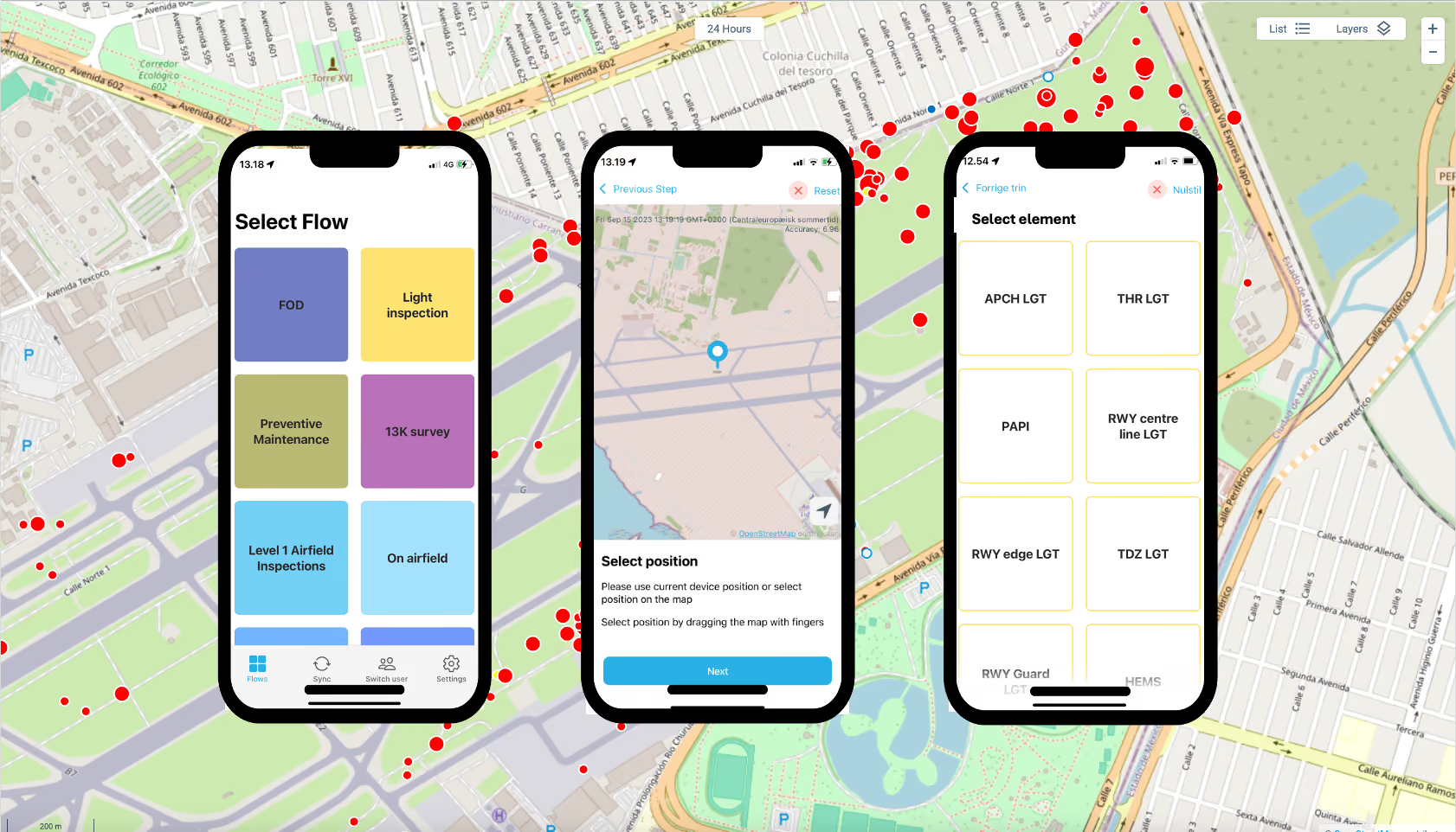
Digital Airside
Digitise every airside process - inspections, wildlife registration, maintenance, and more. One cloud platform, any device. Already supporting data capture at 30+ airports worldwide.
Ascend OrnisSense - Bioacoustic Wildlife Management
AI-powered bioacoustic bird detection, deterrence, and risk monitoring. Four products, one platform.
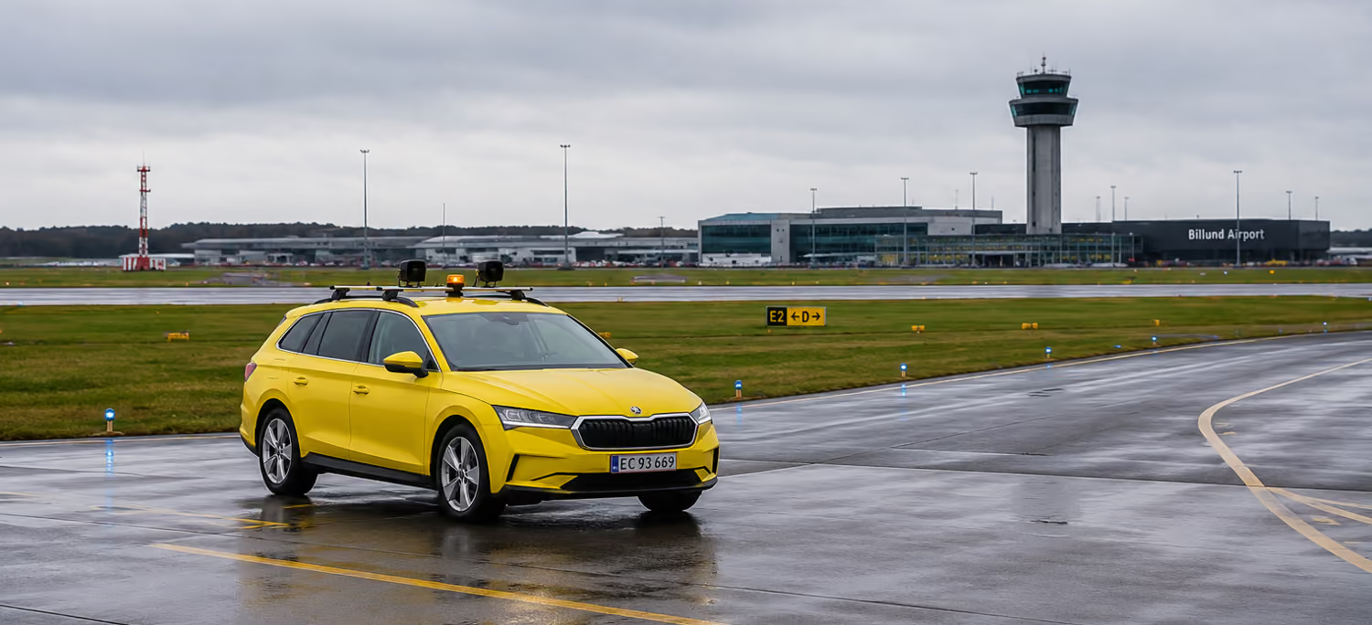
Ascend OrnisSense Patrol
Vehicle-mounted bioacoustic deterrent. Manually activated by the bird controller, playing bioacoustic sounds optimised by the wider network of deployed devices.
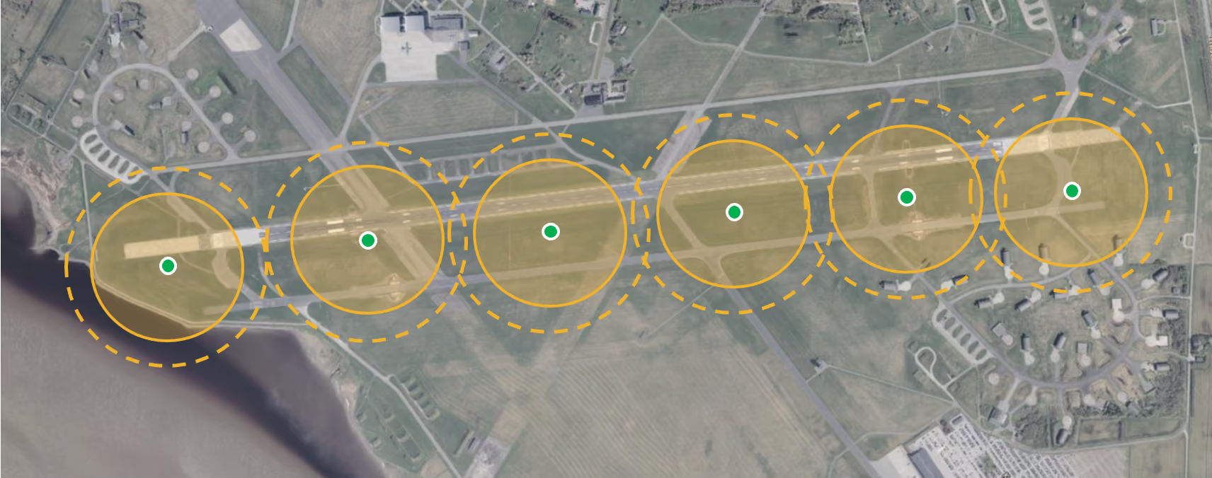
Ascend OrnisSense Grid
Airfield-wide bioacoustic monitoring and deterrent network. Every device visible on a live map with real-time recordings. Remotely activate any unit from the dashboard.
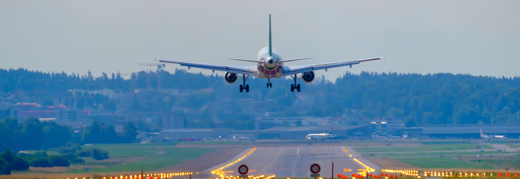
Ascend OrnisSense Corridor
Bioacoustic corridor risk monitoring. Listening devices in arrival and departure corridors feed into the Ascend user interface - with activity prediction based on historical data.
Ascend OrnisSense Surroundings
Bioacoustic airport surroundings monitoring. Deploy mobile listening systems around the perimeter. Bird registrations flow into Digital Airside - as map views and site-specific reports.
Trusted by Forward-Thinking Customers
“With the Ascend solution we get a much better result at a fraction of the cost.”
“I think this is beautiful work and very thoroughly worked through. I am deeply impressed!”
“This is genius and so easy to use!”
One Platform. Every Airside Process.
Digitise runway inspections, light checks, pavement assessments, wildlife registrations, preventive maintenance, and more - in a single cloud-based solution.
Digital Airside - Wildlife logging and much more
No matter if you are performing registrations of wildlife or a runway check, Ascend Digital Airside can digitise the process. Your teams capture data in the field using native iOS and Android apps. Everything flows to the cloud in real time.
All gathered data is instantly available on live maps, in dashboards, and in custom reports for management, specialists, and staff. Already supporting data capture at 30+ airports worldwide.
Core Capabilities - The System Is Matched to your needs
Everything your airside team needs - in one place. You can start with any work process and include more as you see fit.
Real-Time Data Capture
Native iOS and Android apps. Register events and inspections from the field with just a few taps. No paperwork.
User Management
Native iOS and Android apps. Register events and inspections from the field with just a few taps. No paperwork.
Live Map View
See everything happening on your airfield in real time. Filter by type, date, location, or user.
Customisable Workflows
We configure the registration flows that matter to you - FOD, 13K surveys, light inspections, bird strikes, and more.
Task Management
Registrations generate tasks automatically. Track status, progress, and risk levels.
Reporting & Data Export
Custom reports in Word, CSV, and Excel. Full API access for third-party integration.
Ascend OrnisSense - Bioacoustic Intelligence
AI-powered bioacoustic bird detection, deterrence, and wildlife risk management - integrated into Digital Airside.
The Technology
One AI platform. Four products. Continuously learning.
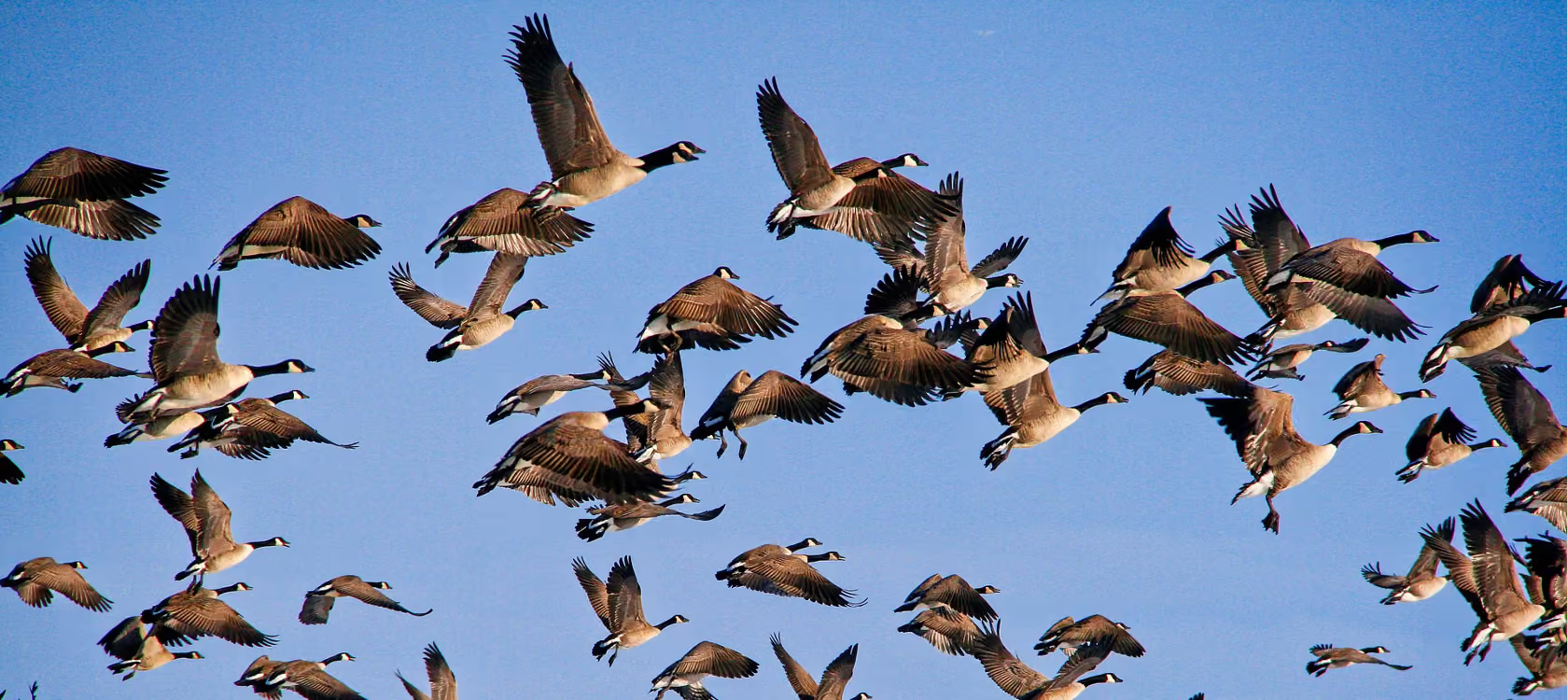
Ascend OrnisSense - powered by BirdAlert - AI-powered bioacoustic technology into your airside operations. The system listens, identifies bird species in real time, classifies risk, and - where needed - deploys adaptive deterrent sounds that continuously learn and improve.
Unlike static pre-recorded sounds, our adaptive bioacoustics measure effectiveness after every activation and adjust automatically. With thousands of units deployed globally, the AI learns from a massive real-world dataset - improving accuracy and effectiveness across the entire network.
How It Works
Detect
AI identifies species by sound in real time
Classify
Species matched to risk level automatically
Deter
Adaptive sounds selected and deployed
Learn
AI measures outcome and improves
Global Learning Network
Every deployed system contributes to a central platform that continuously optimises deterrent effectiveness.
All deployed systems worldwide feed data into a central optimisation platform. The system measures the time from when a bird is detected and deterred until the moment it is detected again. This cycle - detect, deter, measure return time - enables the platform to identify and deploy the most effective deterrent sounds for each species.
The shorter the return time, the less effective the deterrent. The longer the return time, the more effective. By measuring this across thousands of units globally, the system builds an ever-improving library of species-specific deterrent strategies.
Because all systems are online, improvements are pushed to every unit automatically. Your airport benefits from the collective intelligence of every deployment worldwide - and your system never becomes outdated.
How Deterrent Optimisation Works
1. Bird Detected
AI identifies species by vocalisation
2. Deterrent Deployed
Optimal sound selected and played
3. Return Time Measured
How long before the bird is detected again?
4. Network Learns
Longer return = more effective. Data feeds back to optimise all units globally.
Key Differentiators
AI-Powered, Not Pre-Recorded
The system selects deterrents based on real-time species identification and historical effectiveness — not a fixed playlist.
Cloud-Native Platform
Modern browser-based interface accessible from any device, anywhere. No local servers, no manual data transfers.
Continuous Global Learning
Thousands of deployed units generate real-world data that improves detection and deterrence for every airport in the network.
Fully Integrated
All bioacoustic data flows into Digital Airside — alongside inspections, maintenance, and wildlife registrations. One platform, one login.
Backed by Independent Scientific Evidence
Most deterrent systems ask you to take their word for it. Ascend OrnisSense is built on peer-reviewed engineering and validated in independent, government-commissioned field trials - published research that customers and regulators can read for themselves.
The technology is peer-reviewed
The detect–classify–deter–learn approach behind every OrnisSense product originates in doctoral research at Aarhus University on adaptive, sensor-driven wildlife deterrence. The system recognises target conflict species acoustically and distinguishes flock behaviours - foraging, landing, flushing - then varies its response so birds cannot habituate to a repeating sound, the failure mode that limits conventional scaring devices.
Steen, K. A. (2014). Pattern Recognition Methods for Reduction of Human–Wildlife Conflicts. PhD thesis, Aarhus University. See also Steen et al. (2015), Int. J. Sustainable Agricultural Management and Informatics, 1(2), 130–141.
The results are independently validated
Commissioned by the Dutch authorities (BIJ12) and carried out by ecological research institutes Altenburg & Wymenga and Sovon, a two-year field study tracked goose pressure across 65 grassland plots in four provinces. Under the full bioacoustic deterrent configuration, plots saw around 60% fewer geese than under standard practice with no sign of habituation over the deployments and no measurable disturbance to non-target birds.
Kappers, E. F. et al. (2023). Research on the effectiveness of BirdAlert for scaring away wild geese. A&W Report 20-377 / Sovon Report 2022/112, commissioned by BIJ12, Netherlands.
Detection & species recognition
The validated acoustic detection core powers continuous monitoring and risk awareness.
Adaptive, habituation-resistant deterrence
Varied, behaviour-aware responses keep birds moving instead of letting them adapt.
Field-proven effectiveness
Independently measured reduction in goose pressure across full-scale grassland deployments.
Species and Deterrent Ability
We analysed 1,735,550 manually observed birds, all registered during 2025 at airports across the EU. Across this dataset, Ascend OrnisSense - powered by BirdAlert - is effective against an average of 72.8% of birds, rising to 93.7% at individual airports depending on the local species distribution. And that figure keeps climbing: we continuously develop new and updated bioacoustic deterrent sounds to cover more species.
Real-world data
manually observed birds registered across EU airports in 2025
Average effectiveness
of observed birds covered by current OrnisSense deterrent sounds
Best-matched sites
coverage at individual airports, by local species mix
The species present at any airfield are identified continuously, and deterrent sounds are optimised across the global OrnisSense network - so every site benefits as the library grows. New bioacoustic profiles are added on an ongoing basis, steadily extending coverage to more species and lifting effectiveness over time.
Choose Your Product
Four bioacoustic solutions built on the same intelligent technology.
Ascend OrnisSense Patrol
Vehicle-mounted bioacoustic deterrent. Manually activated by the bird controller - playing bioacoustic sounds refined by the global network.
Ascend OrnisSense Grid
Airfield-wide bioacoustic monitoring and deterrent network. Every device visible on a live map with real-time recordings. Remote activation from the dashboard.
Ascend OrnisSense Corridor
Bioacoustic corridor risk monitoring. Registrations flow into the Ascend user interface with activity prediction based on historical data.
Ascend OrnisSense Surroundings
Bioacoustic airport surroundings monitoring. Data accessible as map registrations and site-specific reports.
Ascend OrnisSense Patrol - Bioacoustic Deterrent On the Move
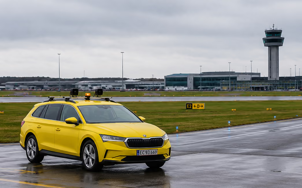
A vehicle-mounted bioacoustic deterrent unit. The bird controller activates the system manually - deploying scientifically validated sounds that have been optimised by the wider network of deployed devices.
Ascend OrnisSense Patrol - Vehicle-Mounted Bioacoustic Deterrent
The vehicle-mounted deterrent unit is activated manually by the bird controller via the Digital Airside app. The unit does not listen or identify species itself - instead, it plays deterrent sounds whose selection and effectiveness have been measured and continuously optimised by the wider network of deployed bioacoustic devices across the airfield and beyond.
These network devices identify species, measure whether deterrent sounds work, and feed that intelligence back into the system. The bird controller activates a deterrent informed by thousands of real-world measurements - not a static playlist. Every activation across the network makes the sounds smarter.
What's Included
Bioacoustic Deterrent Unit
Digital Airside Integration
How It Works
Network Learns
Deployed devices identify species and measure what works
Sounds Optimised
The vehicle unit's sound library is continuously refined
Activate
Bird controller triggers deterrent manually via the app
Deter
Validated sounds deployed, informed by real-world data
Key Features
Network-Informed Sound Selection
The deterrent sounds played are not a fixed playlist - they are continuously optimised by AI species identification and effectiveness measurement across the deployed network.
Manual Activation by Bird Controller
The bird controller stays in charge. They choose when to activate deterrence via the Digital Airside app.
Scientifically Validated Sounds
Deterrent sounds tested and refined across thousands of deployed units globally. Effectiveness measured continuously by the wider network.
Up to Five External Scare Tools
Connect speakers, visual deterrents, and other tools to each unit for multi-stimulus deterrence.
Powered by the Global Network
The vehicle unit's sound library is continuously refined by effectiveness data from every airport in the network - the collective intelligence of thousands of devices worldwide.
Compact and Sealed
Weather-resistant units designed for daily airfield use. Built to last.
Equip your bird control team with intelligent deterrence.
Ascend OrnisSense Grid - Airfield-Wide Bioacoustic Coverage
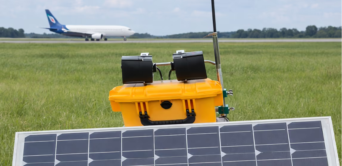
Multiple bioacoustic units with listening devices distributed across the airport. Real-time visibility into bird activity across every zone - with remote bioacoustic deterrence at your fingertips.
Ascend OrnisSense Grid Airfield-Wide Bioacoustic Network
For a typical 3-kilometre runway, you might deploy ten units - five on each side - distributed across the airfield. Each unit continuously listens for bird activity, identifies species, and pushes data back to the bird controller in real time.
This gives the bird controller a total overview of what is happening across the entire airport - including the zones they cannot see visually from their current position. When a threat is identified, the bird controller can remotely trigger any unit in the network directly from the Digital Airside app.
What's Included
Distributed Bioacoustic Units
Network Module
How It Works
Distribute
Units placed across the airfield covering all zones
Listen
Each unit detects and classifies bird species continuously
Overview
Bird controller sees real-time activity across the airport
Trigger
Remote activation of any unit from the app
Key Features
Total Airfield Coverage
Distributed units cover every zone - including areas the bird controller cannot visually observe from their current position.
Live Map with Real-Time Recordings
Every device is visible on a map view. The system shows real-time recordings from each device, building a complete picture of bird activity.
Remote Deterrent Activation
Any unit in the network can be triggered remotely by the bird controller via the Digital Airside app.
Species-Level Detection
Every unit identifies bird species in real time, so the bird controller knows exactly what they're dealing with in each zone.
Scalable to Any Airport
Deploy the number of units that fits your airfield. A 3km runway might use ten units; smaller or larger airports scale accordingly.
Integrated Into Digital Airside
All data flows into the same platform used for inspections, wildlife registrations, and reporting.
Use Cases
Extending the Bird Controller's Reach
The bird controller is in one part of the airfield - but the network shows bird activity building in a zone they can't see. They trigger a remote unit before the situation escalates.
Simultaneous Multi-Zone Response
Bird activity flares in multiple areas at once. The bird controller activates deterrents in different zones from a single dashboard - no need to physically drive to each location.
Night and Low-Visibility Conditions
When visual observation is limited, the network's bioacoustic detection provides continuous awareness of bird activity across the entire airfield.
Data-Driven Patrol Planning
Over time, the network builds a detailed picture of activity patterns across the airfield - informing where and when the bird controller should focus patrols.
See everything. Respond anywhere.
One network.
Ascend OrnisSense Corridor - Bioacoustic Risk Monitoring
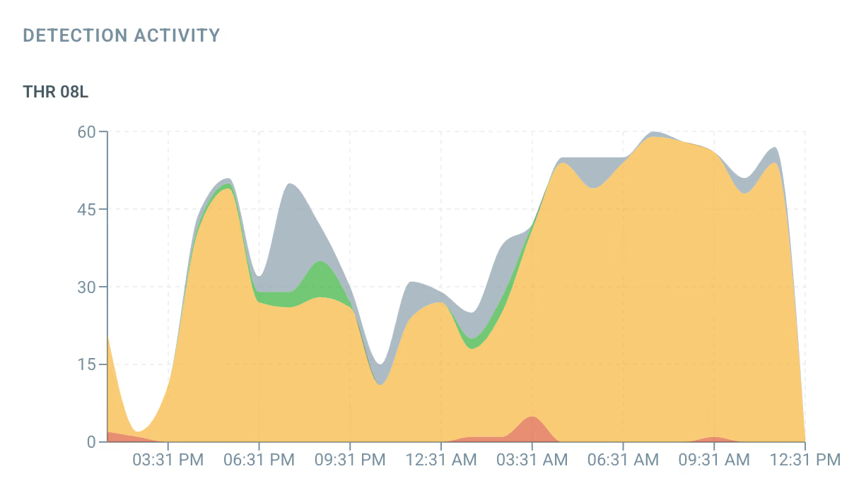
Passive bioacoustic listening devices in arrival and departure corridors — generating activity graphs throughout the day, with detection patterns validated against radar data and activity prediction based on historical data.
Ascend OrnisSense Corridor - Bioacoustic Risk Monitoring
The arrival and departure corridors are among the most critical zones at any airport. Birds in these flight paths pose a direct threat to aircraft, yet most airports lack continuous visibility into the risk these corridors carry throughout the day.
Listening devices are placed in the arrival and departure corridors - passively detecting and classifying bird species by sound. Registrations from the listening devices flow into the solution, generating activity graphs that show bird presence over the course of the day.
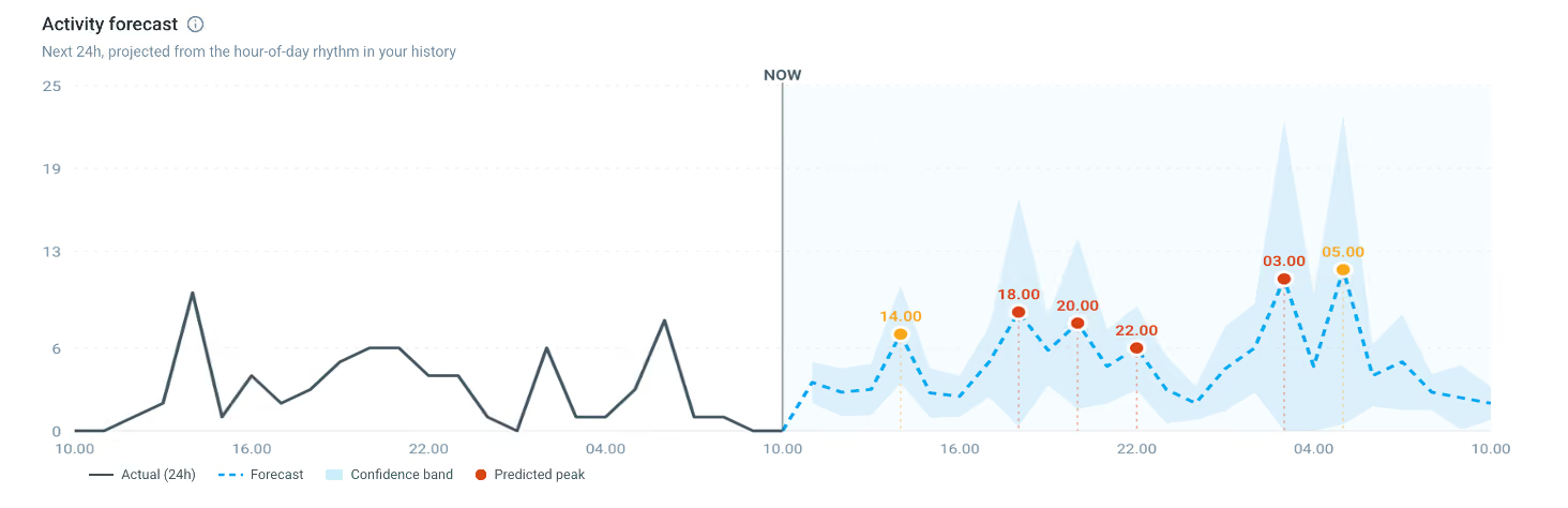
The module includes a prediction of activity based on a progression of historical activity data - helping your team anticipate risk before it materialises.
What's Included
Listening Devices
Corridor Monitoring Module
How It Works
Listen
Devices in corridors detect bird species continuously
Classify
Species identified and matched to risk level
Graph
Activity plotted over the day showing peaks and patterns
Predict
Historical data drives activity forecasts
What You See
Activity graphs showing bird presence throughout the day - with morning and evening peaks matching radar observations.
Monitor the risk in your most critical airspace -
with the species detail radar can't give
When comparing the data from the bioacoustic detection devices with radar data, the same activity peaks are visible. The listening devices detect the same morning and afternoon/evening surges in bird activity that radar systems register.
This validates the bioacoustic approach as a reliable method for monitoring bird risk in arrival and departure corridors - with the added advantage of species-level identification that radar alone cannot provide.
Traditional avian radar provides a count of birds but cannot tell you what species are present or what risk they represent. Ascend OrnisSense Corridor goes further - delivering a live measurement of bird activity per sector, combined with species-level classification matched to your airport's bird risk assessment.
No expensive radar hardware. No complex calibration. Just intelligent, species-level risk monitoring - delivered to your dashboard in real time.
Predictable Peaks - And Unpredictable Ones
Expected Patterns
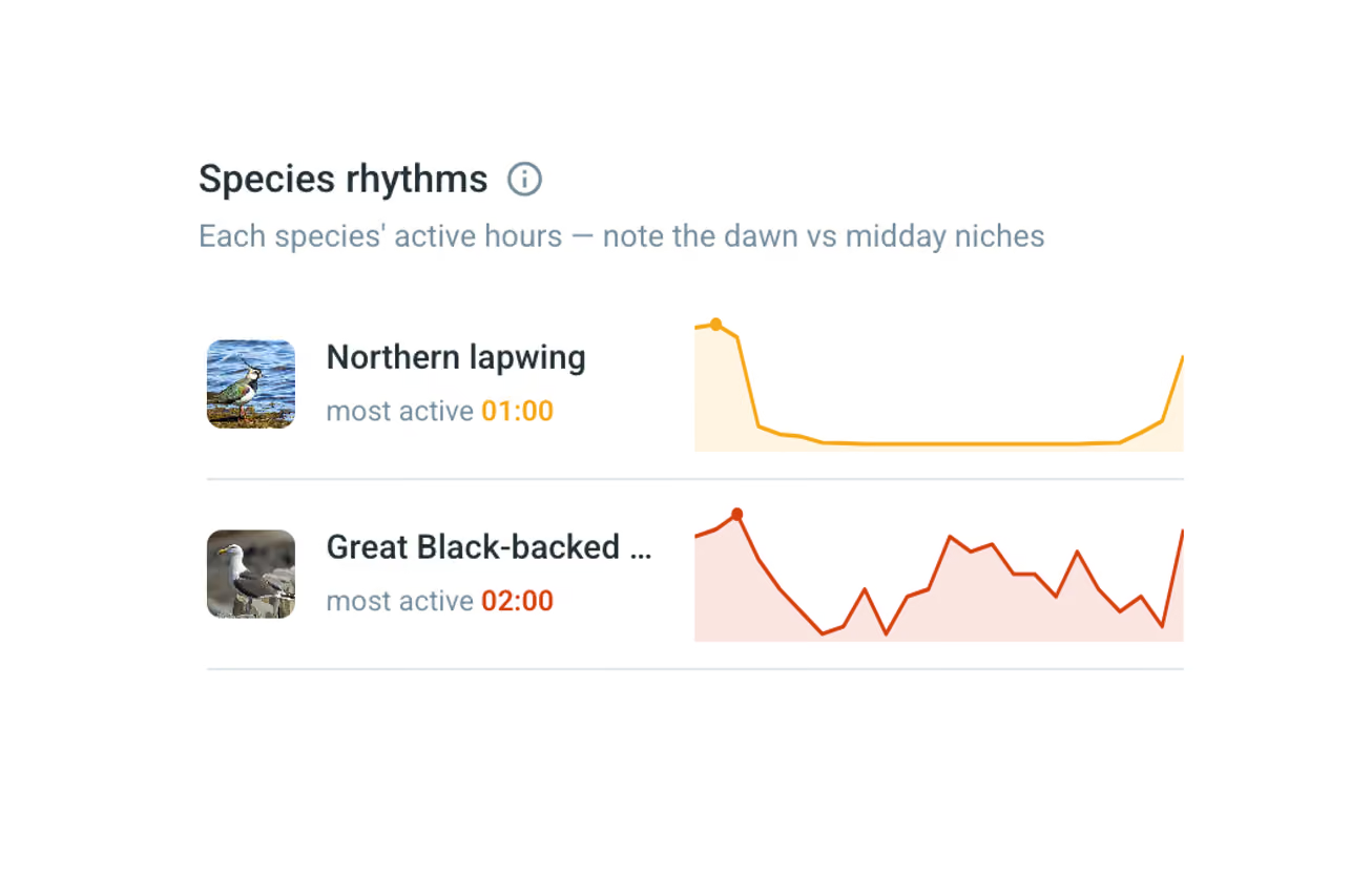
Under normal conditions, the activity graph shows predictable peaks just before sunrise and just before sunset - the periods of highest bird activity. The prediction module uses historical data progression to forecast these patterns, helping staff plan accordingly.
⚠️ Unexpected Spikes
Hundreds or thousands of migrating geese can suddenly appear in the corridor. The system detects these events in real time through their vocalisations and immediately alerts airport staff - giving them the situational awareness to act before aircraft are at risk.
Key Benefits
Statistical Activity Overview
See bird activity patterns throughout the day - identifying when corridors carry the highest risk.
Proven Detection Accuracy
Bioacoustic detection matches radar data peaks - confirmed through comparative analysis of morning and evening activity surges.
Activity Prediction
The module predicts future activity based on a progression of historical data - helping your team anticipate and prepare.
Species-Level Classification
Know exactly which species are present. Risk ratings based on species-specific data - something radar alone cannot provide.
24/7 Continuous Monitoring
Listens around the clock, in all weather, in daylight and darkness. No coverage gaps.
Integrated Into Digital Airside
All data flows into the Ascend user interface and the broader Digital Airside platform.
Match radar on activity spike detection.
Beat it on species classification.
Ascend OrnisSense Surroundings - Bioacoustic Surroundings Monitoring
Airports are required to monitor the areas around the aerodrome for wildlife risk. Our bioacoustic listening devices make this practical, continuous, and data-driven.
Ascend OrnisSense Surroundings - Bioacoustic Surroundings Monitoring
Airports are required to monitor the area surrounding the aerodrome for changes in landscape that could impact wildlife behaviour. A lake, pond, wetland, or landfill near the airport can attract significant bird activity - and that activity needs to be understood.
With Ascend OrnisSense Surroundings, airports can deploy mobile systems at these locations. Data from bird registrations flows into the Digital Airside registration service and can be accessed as registrations on a map as well as reports for the deployed sites - giving the wildlife management team the evidence they need.
Deterrence is optional. The primary purpose is data collection and monitoring - fulfilling regulatory obligations with hard evidence rather than periodic visual inspections.
What's Included
Mobile Listening Devices
Off-Airfield Module
How It Works
Identify
Locate areas of interest — lakes, ponds, fields, attractants
Deploy
Place mobile listening devices at these locations
Monitor
Continuous data on species and activity levels over time
Report
Map views and site reports for compliance
Key Features
Regulatory Compliance
Fulfil the requirement to monitor airport surroundings for wildlife-related landscape changes - with continuous, data-backed evidence.
Mobile Deployment
Devices can be placed at any location of interest and moved as monitoring needs change. No fixed infrastructure required.
Map-Based Registrations
All bird registrations from deployed sites are accessible on a map in Digital Airside - a spatial overview of activity across all monitored locations.
Site-Specific Reports
Generate reports for each deployed site - documenting species, activity levels, and trends over time for compliance and analysis.
Optional Deterrence
If deterrence is needed at a monitored location, the same devices can be configured to activate bioacoustic deterrents.
Integrated Into Digital Airside
All monitoring data flows into the registration service - alongside airfield data, corridor intelligence, and wildlife registrations.
Use Cases
Lake or Pond Near the Airport
A water body within the airport's monitoring zone attracts waterfowl. Deploy a listening device to continuously measure activity and track seasonal patterns - providing documented evidence for risk assessments.
New Construction or Landscape Change
A new development, retention basin, or agricultural change occurs near the airport. Place a device to monitor whether it alters bird behaviour in the area.
Seasonal Migration Routes
Certain areas near the airport become active during specific migration periods. Monitor these locations seasonally to build long-term data on risk patterns.
Landfill or Waste Facility
A nearby waste facility attracts gulls and other species. Continuous monitoring documents the scale of the issue and supports mitigation discussions with facility operators.
About AscendXYZ
A Danish technology company modernising airport operations through intelligent, cloud-native solutions.
Our Story
AscendXYZ is based in Copenhagen, Denmark and specialises in digital solutions for the aviation industry. Our cloud platform is deployed at 30+ airports worldwide, supporting data capture for runway inspections, light checks, wildlife registration, preventive maintenance, and many other airside processes.
We believe every airside process can - and should - be digital. Our platform replaces paper forms, outdated hardware, and disconnected systems with one unified, cloud-based solution accessible from any device.
With the introduction of our Ascend OrnisSense product family - powered by BirdAlert - we have extended the platform into the next generation of airport wildlife management, combining cloud-native airside operations with AI-powered adaptive bird detection and deterrence that learns and improves continuously.
Our Values
Simplicity
Complex processes, simple interfaces. If it takes more than a few taps, we haven't finished designing it.
Intelligence
Data should work for you. From AI bird detection to automated risk classification — raw data becomes actionable insight.
Openness
Full API access, data export in any format, seamless third-party integration. Your data is yours.
Continuous Improvement
Our AI learns from every detection. Our platform evolves with every customer. We never stop.
Let's Talk
Ready to start a trial, need a tailored solution, or just want to learn more? We're here to help.
Contact Us
Ascend ApS
Dalvangen 25
2700 Brønshøj
Denmark
Phone: +45 30 22 35 51
Email: info@ascendxyz.com
CVR/VAT: DK35524495